The Flysch Route, Zumaia (Basque Country)

Spain’s 15 global geoparks, spectacular landscapes that reveal the history of Earth

none

Spain’s 15 global geoparks, spectacular landscapes that reveal the history of Earth


Did you know Spain is the world’s second ranking country in UNESCO biosphere reserves? At first glance, geoparks are natural spaces with landscapes of extraordinary beauty. But visitors can discover much more: their mountains, rock formations, and soil all reveal the history of humanity and our planet. That’s why, since 2015, UNESCO has recognised their value with the Global Geopark label - and in Spain there are 15 of them, open for geotourism.

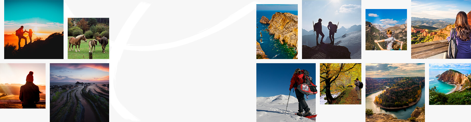
Cabo de Gata-Níjar geopark, Almería (Andalusia)

A place where winter never comes, a coast of rugged cliffs and hidden coves. The result of the impact between the tectonic plates of Africa and Europe, its volcanic landscape is home to little fishing villages of whitewashed houses. You can explore it on all-terrain vehicles, on horseback, or hiking. The clear coastal waters reveal a sea bed rich in wildlife and volcanic formations which can easily be enjoyed close up with snorkelling and scuba diving available for all levels on the Isleta del Moro. If you get the chance, round off your trip with a boat tour along the coast and discover secret coves you’ll remember forever.

Cabo de Gata-Níjar Natural Park

Subbeticas Geopark, in Cordoba (Andalusia)

Water, in the form of rivers and springs, is the element that has transformed this territory, carving eccentric shapes into the limestone. This is a land of olive trees and little villages of whitewashed houses nestling among the mountains, like Zuheros, Cabra, Luque and Doña Mencía. This area is ideal for exploring by bicycle, with plenty of special routes, including the Olive Oil Train Greenway. If you prefer hiking, the trails of La Nava and Cañón del Río Bailón are the most popular for combining with car tours. You’ll discover lots of caves, including the outstanding Los Murciélagos cave (in Zuheros, guided tours are available). And it’s almost obligatory to see the views from the Balcón de Andalucía (at the chapel of Nuestra Señora de la Sierra, in the Cabra mountains).

Bailón gorge, Zuheros (Córdoba)

Sobrarbe-Pyrenees Geopark, Huesca (Aragon)

The Pyrenees Geopark offers a journey through the origin of the mountains, the last glaciers of Spain, vast caves among vertiginous canyons and gorgesand even the former home of the cave bear: the Oso de Tella Cave. The Geopark has numerous hiking and mountain bike routes taking you to some of the most spectacular scenery. Climbers can enjoy the via ferrata next to the Sorrosal waterfall, and a geo-mining tour of several different mines that once operated in the area. Other geological sights include the landscape around Eripol (there is a viewing point on the outskirts, next to the cemetery, where you can see how the gradual retreat of the sea over centuries shaped the mountains) and the glacier of Monte Perdido (in Bielsa). The visitors’ centre is in Aínsa.

Landscape in Aínsa, Huesca (Aragon)

Basque Coast Geopark, Gipuzkoa (Basque Country)

A living display of 60 million years of history. This is the Flysch route, visiting the most striking geological feature of the Basque coast, in the municipalities of Zumaria, Deba and Mutriku. These 13 kilometres of stunning cliffs and outcrops of sedimentary rocks known as flysch are of interest to geologists, not least because they help them study prehistorical periods such as the extinction of the dinosaurs. Itzurun beach (Zumaia) is probably the best place to see the flysch. It’s also where the visitors’ centre is located. Boat tours leave from here, where you can see the beauty of the cliffs from the sea. If you can, wait to see the sunset from the beach or the sea, because it’s quite unforgettable. Further inland, the Geopark includes green valleys and mountains with caves boasting World Heritage rock art, such as the Ekain cave.

The Flysch Route, Zumaia (Basque Country)

Sierra Norte de Sevilla Geopark, Andalusia

Here the landscape has been shaped over 700 million years. From one of the world’s largest collections of jellyfish fossils to the traces revealing a meeting of tectonic plates (in Beja-Acebuches), the Sierra Norte de Sevilla Geopark offers several geotourism routes through important points of geological interest. You can also walk or cycle along the Sierra Norte de Sevilla Greenway from the natural monument of Cerro del Hierro to the waterfalls, known as the Huesna or Huéznar falls. Cerro del Hierro is a former iron mine that uncovered impressive rock formations, and Huesna boasts a series of waterfalls and pools. Along the way, you’ll have the chance to see the cinereous vulture and the Spanish imperial eagle in flight.

Cerro del Hierro, Sierra Norte de Sevilla Geopark

Villuercas-Ibores-Jara Geopark, Cáceres (Extremadura)

This landscape was formed in Pangaea, around 300 million years ago. Climbing to the highest point, the ridge of La Villuerca, you get a sweeping view which reveals the character of the Geopark, a landscape of mountain ranges, valleys and hills. You’ll find dense oak and chestnut woodland with fauna including the golden eagle, peregrine falcon, griffon vulture and eagle owl. Its points of geological interest include Estrecho de la Peña Amarilla (a ravine in Alía); Marmitas de Gigante del río Ibor (in Bohonal de Ibor), a gorge created by water erosion where you can swim if the weather is warm, and the blockfields of Peraleda de San Román (an area of rounded and mushroom-shaped rock formations, especially the enormous boulders of Cancho del Castillo). Near this area are the Jerte Valley (noted for its cherry blossoms in spring) and Guadalupe with its famous monastery of Santa María de Guadalupe, a World Heritage site.

Cabañas del Castillo, in the Villuercas-Ibores-Jara Geopark, Cáceres (Extremadura)

Central Catalunya Geopark

Did you know the centre of Catalonia was once a huge saltwater basin? This was at the time the Pyrenees were taking shape, 36 million years ago. The water evaporated, leaving a beautiful landscape which is now this Geopark. The mountain of Montserrat, with its peculiar rounded rock formations, is one of its symbols. We recommend visiting the rest of the area as well, including the Monastery of Santa María de Montserrat and some of the caves under the mountain. In nearby Moyá (Barcelona) you can visit the Toll Caves, with important prehistoric and palaeontology finds. For a different way to enjoy the Geopark, we suggest the “Wines of the Geopark” route, visiting the wineries of the Pla de Bages designation of origin.

Cable car in Montserrat (Catalonia)

El Hierro island Geopark, in the Canary Islands

The landscapes of El Hierro are famous for their unique beauty. The island is volcanic in origin, like all the Canary Islands, and it’s easy to find lava flows, coulées, volcanic sediments and rock formations of great geological interest. In fact, volcanic activity is still going on and there was an underwater volcanic eruption in 2011. A good place to find out more about its volcanoes is the Geopark visitors’ centre in El Pinar. You can see the effect of volcanic activity on the landscape from viewing points at Jinama, La Peña, Bascos and La Llanía. Whether you are driving or cycling, the road from Valverde to San Andrés reveals all the variety of landscapes on the island, with agricultural areas, sea views and steep cliffs. In San Andrés you can hear about the legend of the Garoé tree and the phenomenon of horizontal rain. And if you visit La Dehesa, you can see the effect of the trade winds in El Sabinar, with trees twisted into spectacular shapes.

Landscape of El Hierro Island

Molina de Aragón and Alto Tajo Geopark, Guadalajara (Castilla-La Mancha)

Ancient rivers and warm seas shaped this terrain of deep ravines, unique trees and points of geological interest. Interesting sites include fossil deposits of marine creatures over 430 million years old (graptolites), close to Checa, and the fossil forest of Sierra de Arangocillo. To explore this very large Geopark, with over 4,000 square metres, there are 11 signed georoutes and several visitors’ centres. We recommend visiting its miradores (viewing points) to see the spectacular scenery, very different from season to season. Barranco de la Hoz is always one of the best. In autumn you can enjoy the changing colours on the riverbanks from the Mirador del Tajo viewing point. In winter, the Mirador del Pellejero looks out over snow-covered peaks. And in spring, the Mirador del Machorrillo offers beautiful views over the lake of Taravilla.

Alto Tajo Park, Guadalajara

Lanzarote island and Chinijo Islands Geopark, in the Canary Islands

An island of mountains formed by fire and extraordinary volcanic landscapes. Timanfaya National Park is a must-see, with a tour of the Timanfaya volcano and surprising experiences like eating food cooked over lava. This terrain is full of thermal anomalies and can reach 250 ºC in some areas, where you can see boiling water erupting in geysers. Tinajo is a town with plenty of geological sights, such as El Cuervo volcano, Montaña Colorada and Caldera Blanca, all with easy hiking routes. Another unique landscape is in La Geria, where farmers have adapted grapevine growing techniques to the volcanic terrain.

Landscape of the Timanfaya National Park

The influence of volcanic activity can be seen everywhere on the island, even the coastline with beaches like Papagayo (in the south) and unusual places like the green lake, Charco de los Clicos or Lago Verde. The best way to explore the island in depth is by visiting the Art, Culture and Tourism Centres where the volcanic nature of the island is sustainably integrated with the art of César Manrique.

Peña Amaya, Las Loras Geopark, in Burgos and Palencia

Las Loras Geopark, in Burgos and Palencia (Castilla y León)

A rugged terrain with imposing ravines and rocky outcrops, where you can find more Romanesque churches, convents and monasteries per kilometre than anywhere in Europe. These are the distinguishing features of Las Loras Geopark, which offers plenty of routes to explore on foot, by car or mountain biking. Some of the most spectacular landscapes are the gorges of the rivers Ebro and Rudrón (in Burgos) and Las Tuerces (in Palencia), close to the interesting Cave of Los Franceses and the recommended Mirador de Valcabado viewing point. Throughout most of the park you’ll also find pre-Roman castros, Neolithic dolmens, and Iron Age sites like the castros of Monte Bernorio, Peña Amaya, Peña Ulaña and Monte Cildá. Many of the park’s waterfalls are easy to access, such as those of Orbaneja del Castillo (Burgos) and Covalagua (Palencia). The area is ideal for adventure sports like rock climbing or canyoning.

Conca de Tremp-Montsec Geopark, in Lleida (Catalonia)

A UNESCO Geopark since 2018, its rocks tell the story of over 550 million years of history. This area was once under the sea, later dinosaurs lived here almost until their extinction, and today it offers a wealth of picture-perfect landscapes and one of the clearest skies for stargazing, recognised by Starlight. Its most photogenic spots include the Mont Rebei ravine, where a breathtaking path has been carved into the rock, up to 500 metres above the river. Its best-known route is the Ruta del Quinto Lago, going through enchanting medieval villages like Peramea, Beranui and Les Esglésies and ending at Lake Montcortés, fed by an underground spring. Another great way to enjoy the diverse landscape is on the Tren dels Llacs, a period sightseeing train which runs from Lleida to La Pobla de Segur through the scenery of the Pyrenees. There are also numerous fossil deposits in the Geopark, including dinosaur fossils and footprints. You can find much more information about them in the Dinosfera Centre in Coll de Nargó.

Entrance to Mont Rebei gorge in the Conca de Tremp Geopark

Courel Mountains Geopark, in Lugo (Galicia)

Here the landscape reveals how the terrain has changed over 500 million years and its close relationship with human activity. The area has been mined since the times of the Roman Empire, and slate was an important part of the local economy from the Neolithic era to just a few years ago. UNESCO made Sierra do Courel a Global Geopark in April 2019, emphasising the conservation of its medieval villages and monasteries, and the beauty of its ravines and valleys, formed by erosion. The Geopark includes the municipalities of Quiroga, Folgoso do Courel and Ribas de Sil, in Lugo province. Its unusual flora is another of its attractions, especially the beautiful orchids (guided tours are usually organised in May to see the orchids in peak flowering season).

O Courel, Lugo

Granada Geopark, in Andalusia

It became part of the worldwide network of Geoparks in 2020, and offers the opportunity to discover an environment which tells a story five million years old. Here you can see the traces of ancient seas, mountains which were once underwater lava flows, and one of Europe’s largest complexes of palaeontology sites with Quaternary vertebrates. Humans have also left their mark on the landscape, including cave houses carved into the mountainside, early precursors of today’s bioclimatic homes.

Hoyas de Guadix in the Granada Geopark, in Andalusia

Maestrazgo Geopark, in Teruel (Aragón)

This is what people mean when they talk about places where the silence speaks. Tall peaks, deep gorges, rivers of clear water and paths through pine woods to tranquil, peaceful villages. You can see for yourself in towns like Cantavieja, Mirambel, Puertomingalvo, and Aliaga. The landscape reveals the last 200 million years of Earth’s history, with a network of signposted routes for exploring it. The most interesting natural sights include the Crystal Caves of Molinos, Órganos de Montoro, and the source of the river Pitarque. You can also see some of the archaeological sites forming part of the UNESCO World Heritage site Rock Art of the Mediterranean Basin

Órganos de Montoro, Maestrazgo Geopark, Teruel